


Voting District 030005, Putnam County, New York
About
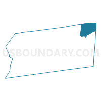
Outline

Summary
| Unique Area Identifier | 634091 |
| Name | Voting District 030005 |
| County | Putnam County |
| State | New York |
| Area (square miles) | 10.87 |
| Land Area (square miles) | 10.84 |
| Water Area (square miles) | 0.03 |
| % of Land Area | 99.69 |
| % of Water Area | 0.31 |
| Latitude of the Internal Point | 41.50388710 |
| Longtitude of the Internal Point | -73.57297850 |
Maps


Graphs
Select a template below for downloading or customizing gragh for Voting District 030005, Putnam County, New York


Neighbors
Neighoring Voting District (by Name) Neighboring Voting District on the Map
- Voting District 030001, Putnam County, NY
- Voting District 030002, Putnam County, NY
- Voting District 030007, Putnam County, NY
- Voting District 030008, Putnam County, NY
- Voting District 120001, Dutchess County, NY
- Voting District 120002 120006, Dutchess County, NY
- New Fairfield 108 Voting District, Fairfield County, CT
- Sherman 1 Voting District, Fairfield County, CT
Top 10 Neighboring County Subdivision (by Population) Neighboring County Subdivision on the Map
- New Fairfield town, Fairfield County, CT (13,881)
- Patterson town, Putnam County, NY (12,023)
- Pawling town, Dutchess County, NY (8,463)
- Sherman town, Fairfield County, CT (3,581)
Top 10 Neighboring Place (by Population) Neighboring Place on the Map
Top 10 Neighboring Elementary School District (by Population) Neighboring Elementary School District on the Map
Top 10 Neighboring Unified School District (by Population) Neighboring Unified School District on the Map
- Carmel Central School District, NY (30,273)
- Brewster Central School District, NY (22,139)
- New Fairfield School District, CT (13,881)
- Pawling Central School District, NY (9,030)
Top 10 Neighboring State Legislative District Lower Chamber (by Population) Neighboring State Legislative District Lower Chamber on the Map
Top 10 Neighboring State Legislative District Upper Chamber (by Population) Neighboring State Legislative District Upper Chamber on the Map
Top 10 Neighboring 111th Congressional District (by Population) Neighboring 111th Congressional District on the Map
Top 10 Neighboring Census Tract (by Population) Neighboring Census Tract on the Map
- Census Tract 102, Putnam County, NY (8,179)
- Census Tract 2202, Fairfield County, CT (4,893)
- Census Tract 1100.03, Dutchess County, NY (4,063)
- Census Tract 101, Putnam County, NY (3,844)
- Census Tract 2571, Fairfield County, CT (3,581)
- Census Tract 1100.04, Dutchess County, NY (2,053)